Madeira Adventure: Day 2 – coastal hike and walking on the surface of another planet
by Monika Suchoszek
The first day was already intense, but for the second, we planned even more: two dramatically different hikes—the rugged, barren landscapes of The Dragon’s Tail and the lush, coastal beauty of Vereda do Larano. The first one offered a feeling of being on another planet, especially with the rising sun that made the colors of the landscape truly spectacular.
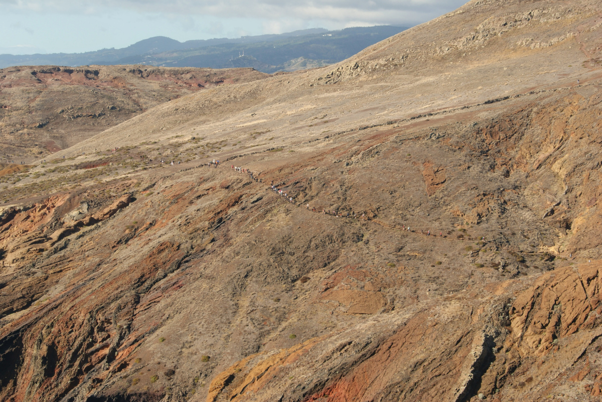
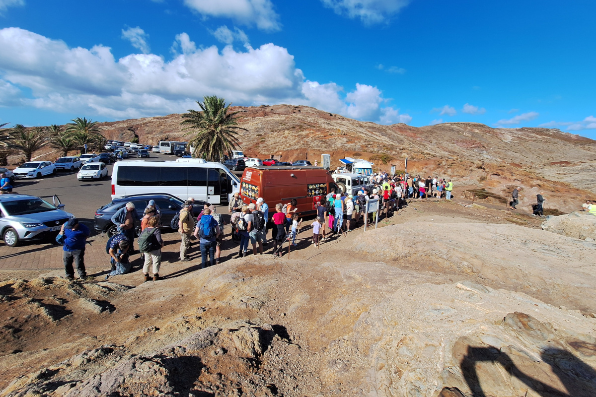
We were advised to leave Funchal before 8:00 AM to avoid traffic. Solid advice, as parents drop off their kids at schools in the center of Funchal, which in combination with people getting to their workplace gets really busy. We arrived at an empty São Lourenço parking lot around 8:10 AM, but by the time we finished the hike at 11:00 AM, cars were parked up to 1.5 km away from the start of the hike, reaching another big parking lot close to the Resort Spa & Marina hotel. We always made it a point to do the most famous hikes first thing in the morning to avoid crowds and parking issues. That day, not only was parking much easier, but the number of people we encountered on the way back was drastically higher. It was surreal to start the hike with almost no one around and then finish with a line of people going the opposite direction. When we started our hike, there were already a few people coming back, they had surely gone there to see the sunrise. We once hiked up Poon Hill in the dark and on an empty stomach to see the sunrise, but learned this isn’t for us.

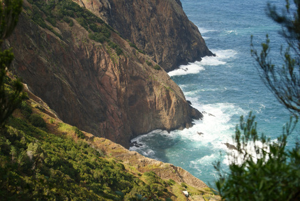
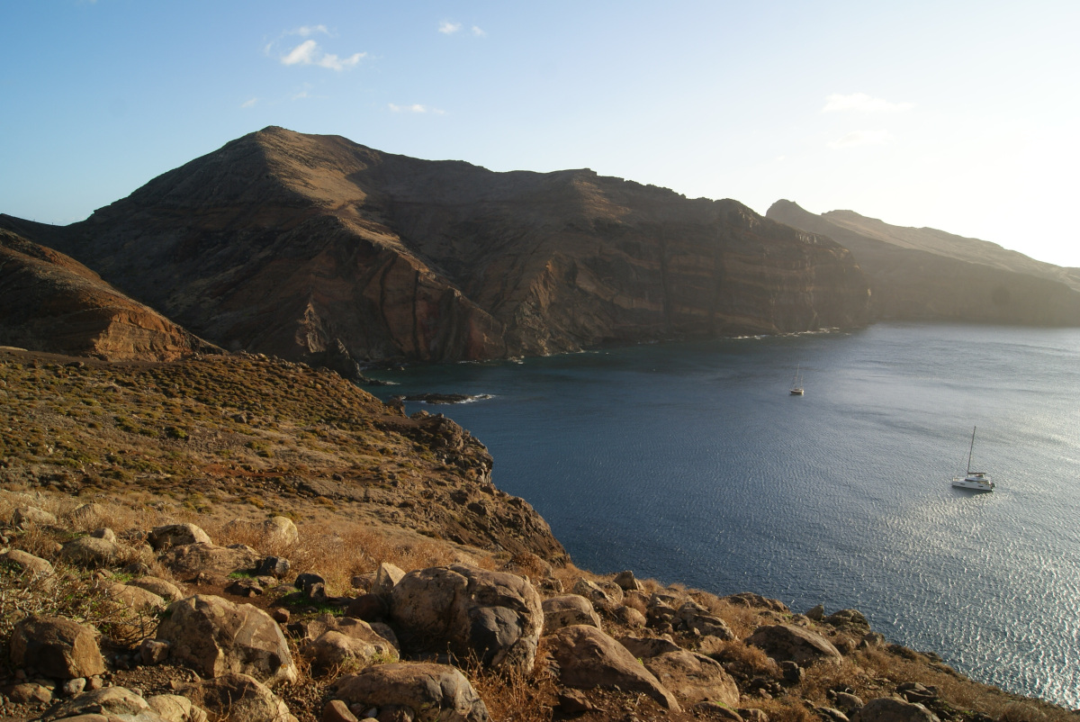
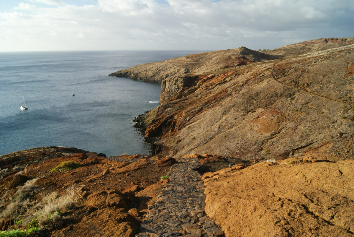
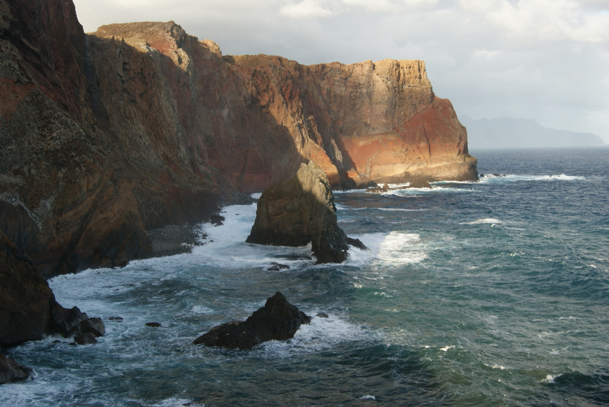
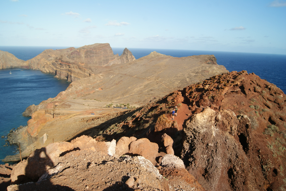
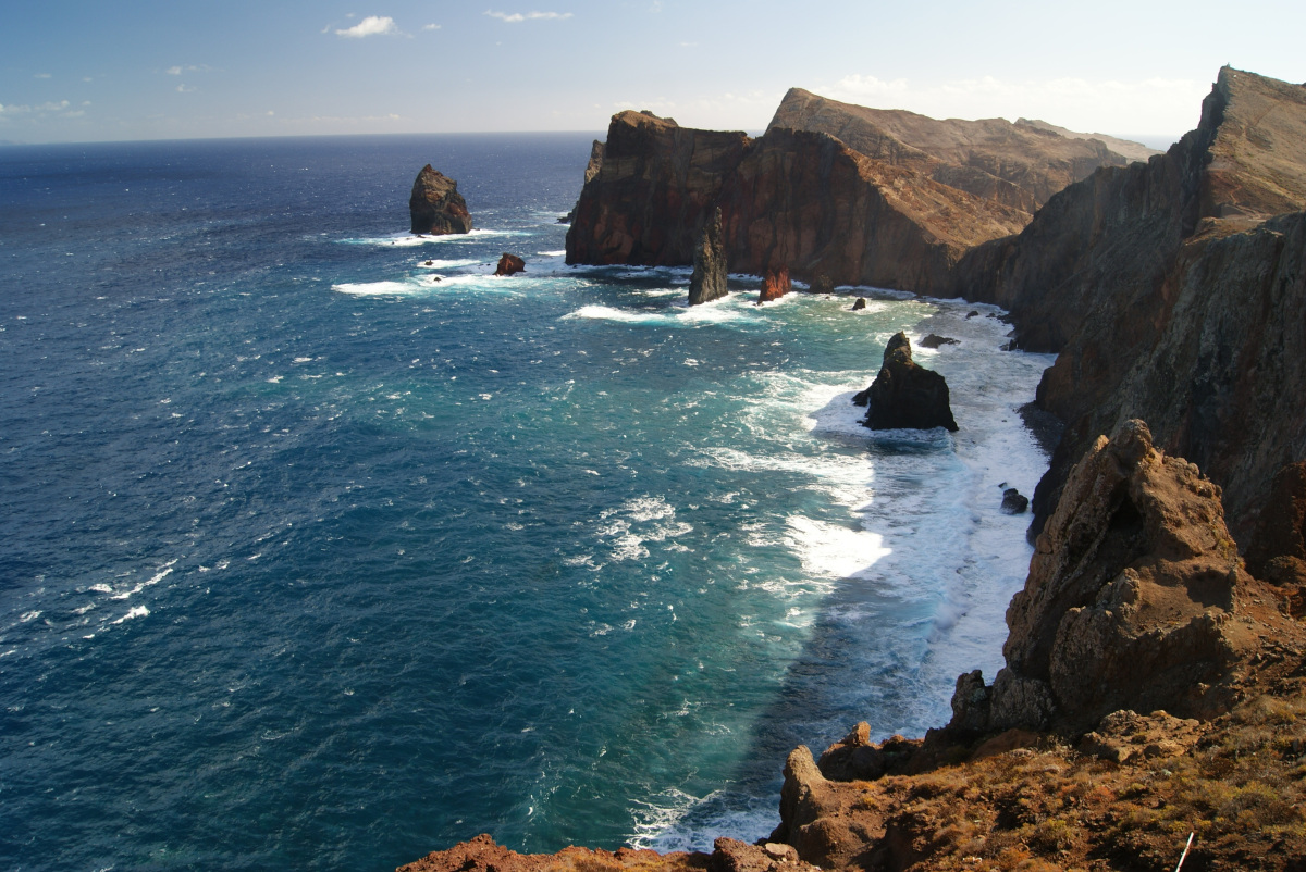
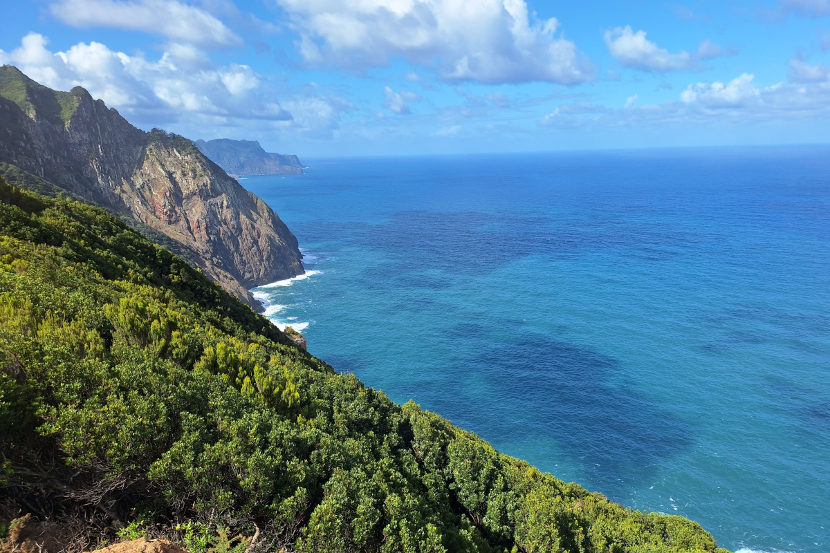
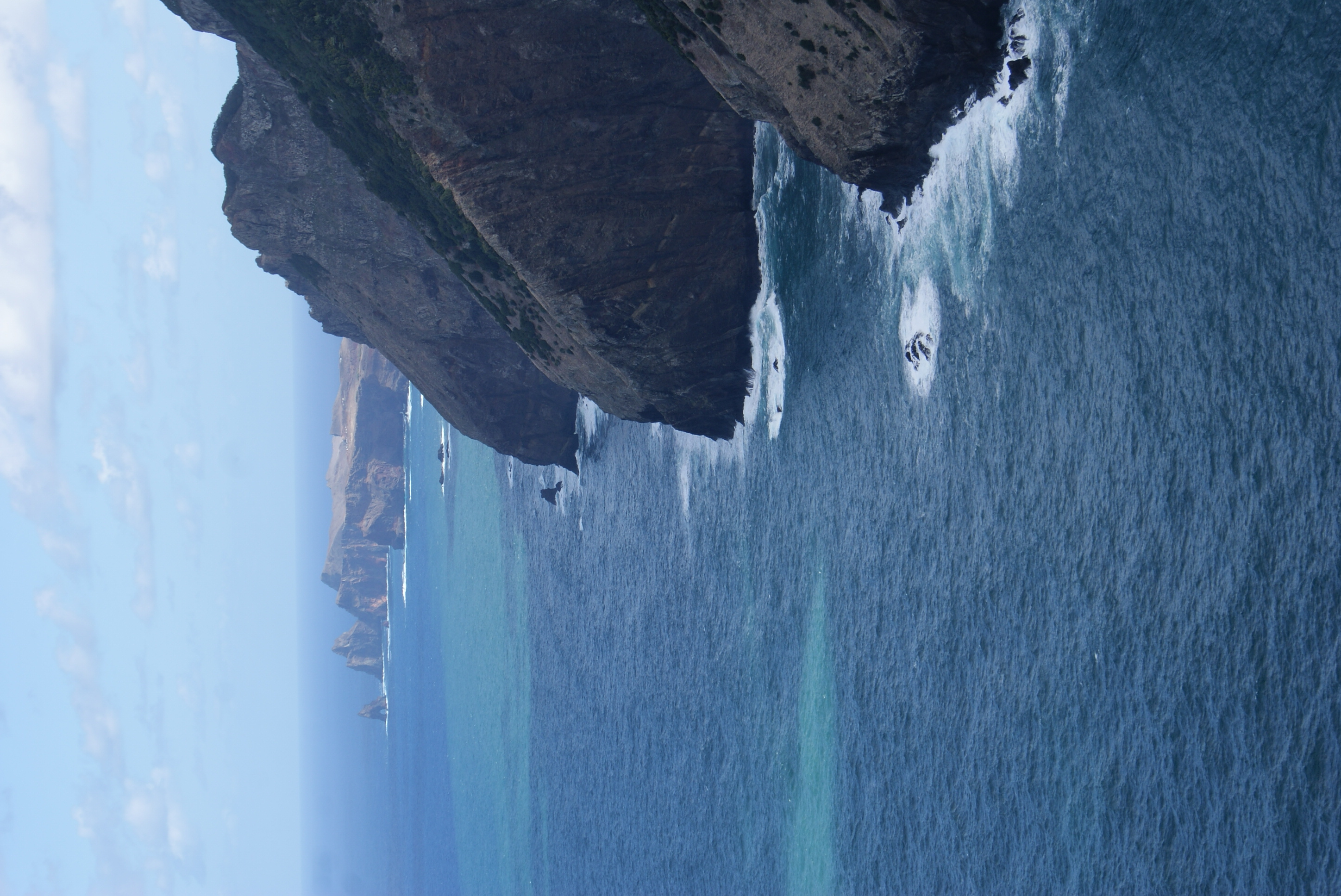
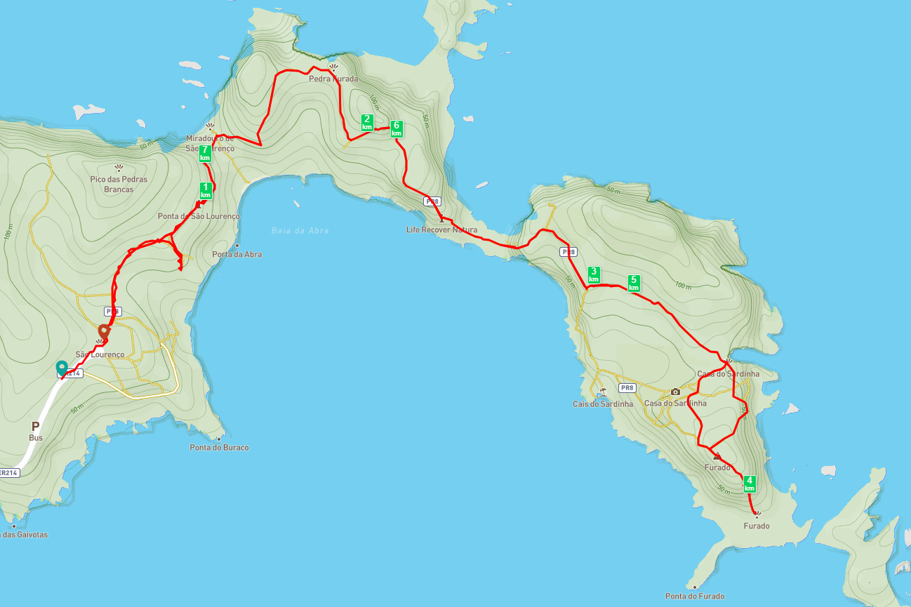
The Ponta de São Lourenço peninsula is called the Dragon’s Tail because of its shape, especially when seen from above. The morning sun was amazing—the colors were warm, and the place was unbelievably quiet. That day, there was almost no wind, and the ocean looked very calm. We particularly liked the red-colored, iron-rich volcanic rock called basalt and the stark landscape devoid of vegetation, which made this place look surreal. The contrast between the red, black, and yellowish rocks and the blue ocean in this area makes the landscape even more unique. During the hike, we also observed boats coming to the nearby bays and fishing nets used by local fishermen. This area is known for its rich marine biodiversity.
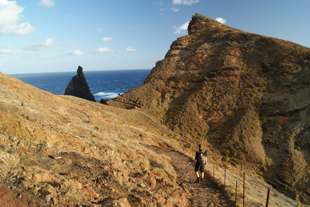
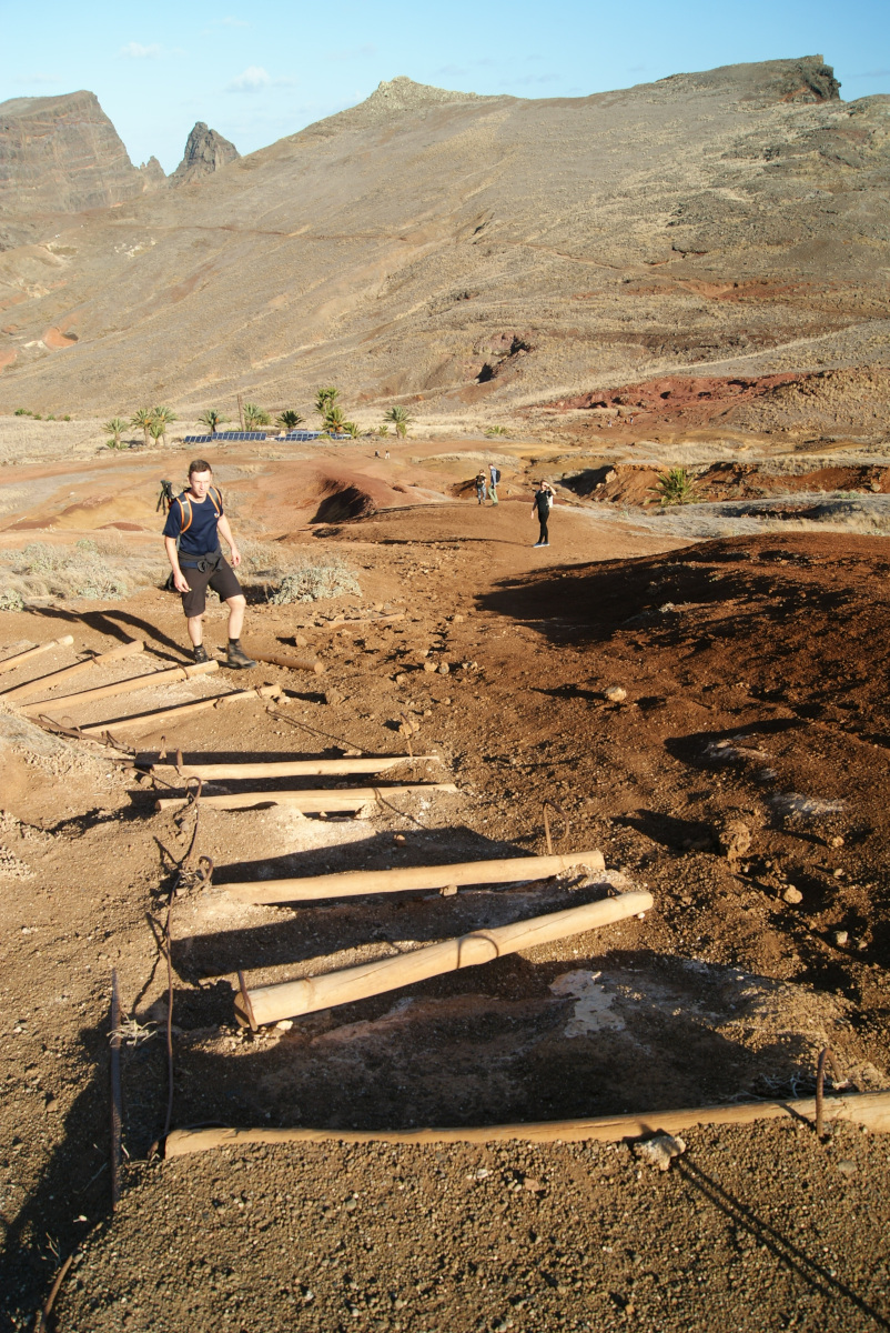
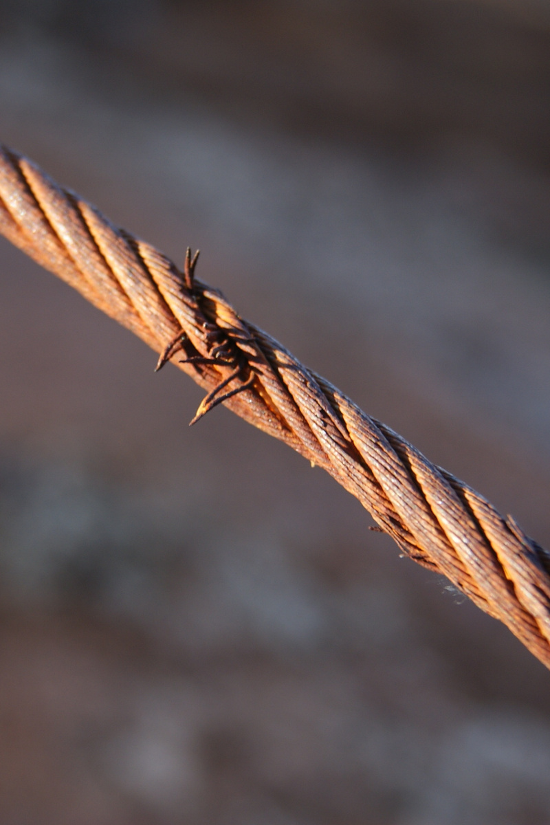
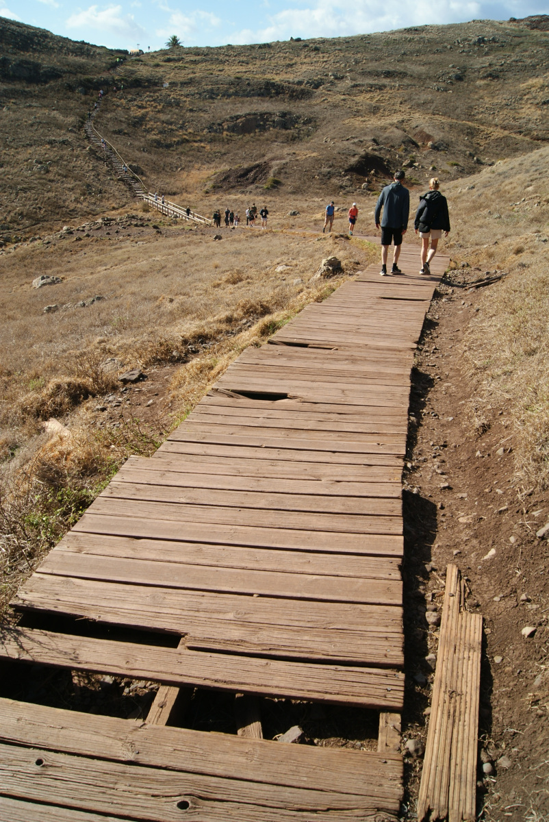
Good shoes are definitely a must, as the path is rocky, especially toward the end, where it becomes more demanding. After passing the café, the last stretch climbs steeply uphill, with wires to hold onto. However, many of these wires were rusty and therefore dangerous, and large sections of the path was broken and in poor condition. Additionally, the wire used to assist with the climb was broken or missing in many places, with some sections having fallen or frayed, leaving sharp bits sticking out that could easily cut your hands. The challenging trail conditions make the café you’ll encounter even more appealing, as it stands like a little green oasis surrounded by palm trees. Great stop for everyone that needs a coffee break or grab something sweet.
At the very end of the trail there is a viewpoint where the protective fence was damaged. We noticed several people stepping beyond it to the very edge to snap better pictures, which struck us as quite irresponsible given the steep drop. One downside of hiking so early during this time of year was that the peninsula’s tip—known as the “Dragon’s Tail”—was barely visible from this viewpoint due to the sharp sunlight shining directly into our eyes.
We arrived in Madeira the same week that the government started applying fees (October 28, 2024) to the most stunning trails, including this one. We bought our tickets online, but when we arrived shortly after 8 AM, there was an older man with paper tickets getting ready for the day. After our hike, a small queue had formed with people trying to buy tickets with cash, and two additional younger park rangers were checking them. I hope this money will be used to renovate the trails and make them safer, as this one was in bad shape, with broken wooden boards in several places. According to the government’s statement, all profits from the new tourist fee will go toward trail maintenance, cleaning, and preservation efforts. With Madeira experiencing a rise in tourism, this change was really necessary. The number of people we passed on the way back to the car was remarkable—the highest during our whole stay.
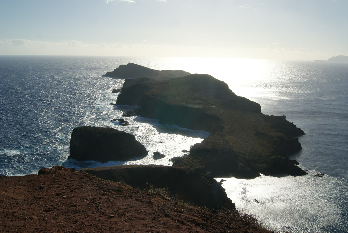
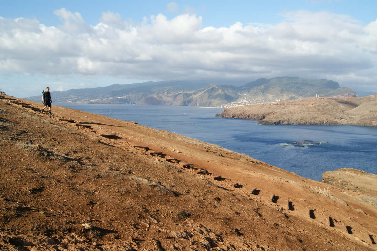
Miradouro da Ponta do Rosto was our next stop since it is located just a couple hundred meters from the road leaving the PR8 hike. It gave us a great overview of the part of the hike we just did, from another angle. We could see dramatic cliffs with colorful volcanic rock formations. Ponta de São Lourenço is one of Madeira’s must-visit hikes, offering a completely different experience from the island’s lush levada trails. I really enjoyed this walk with truly mind-blowing scenery! This easternmost point of Madeira Island is just unreal and a must-see for everyone visiting. I was very happy that we didn’t arrive too late and could quickly move on to our next goal for the day: a longer coastal hike to Porto da Cruz.
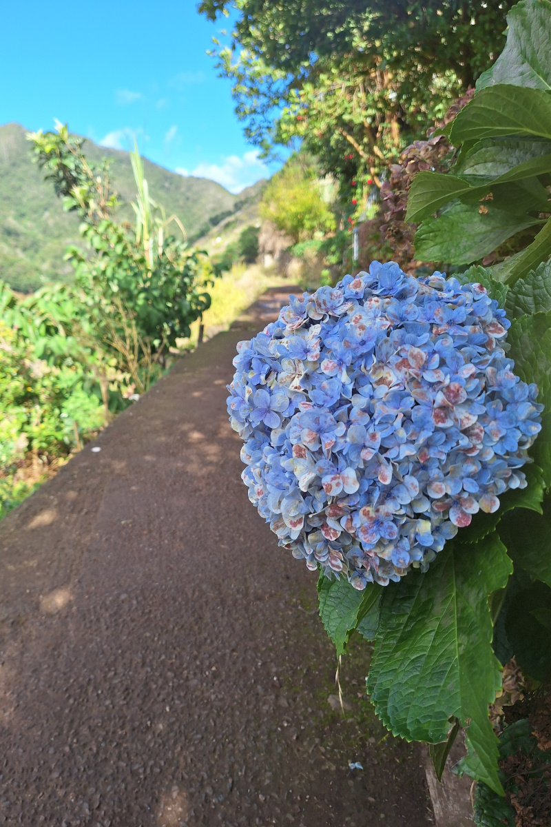
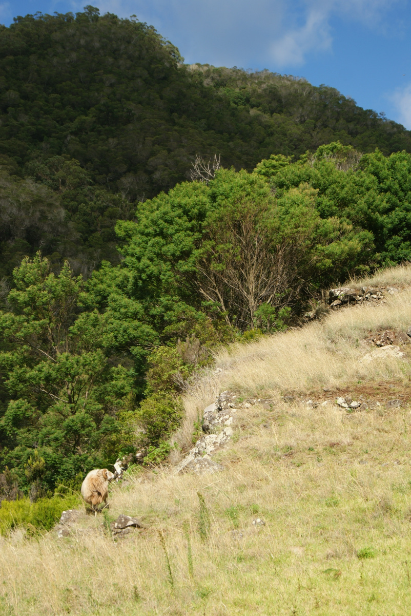
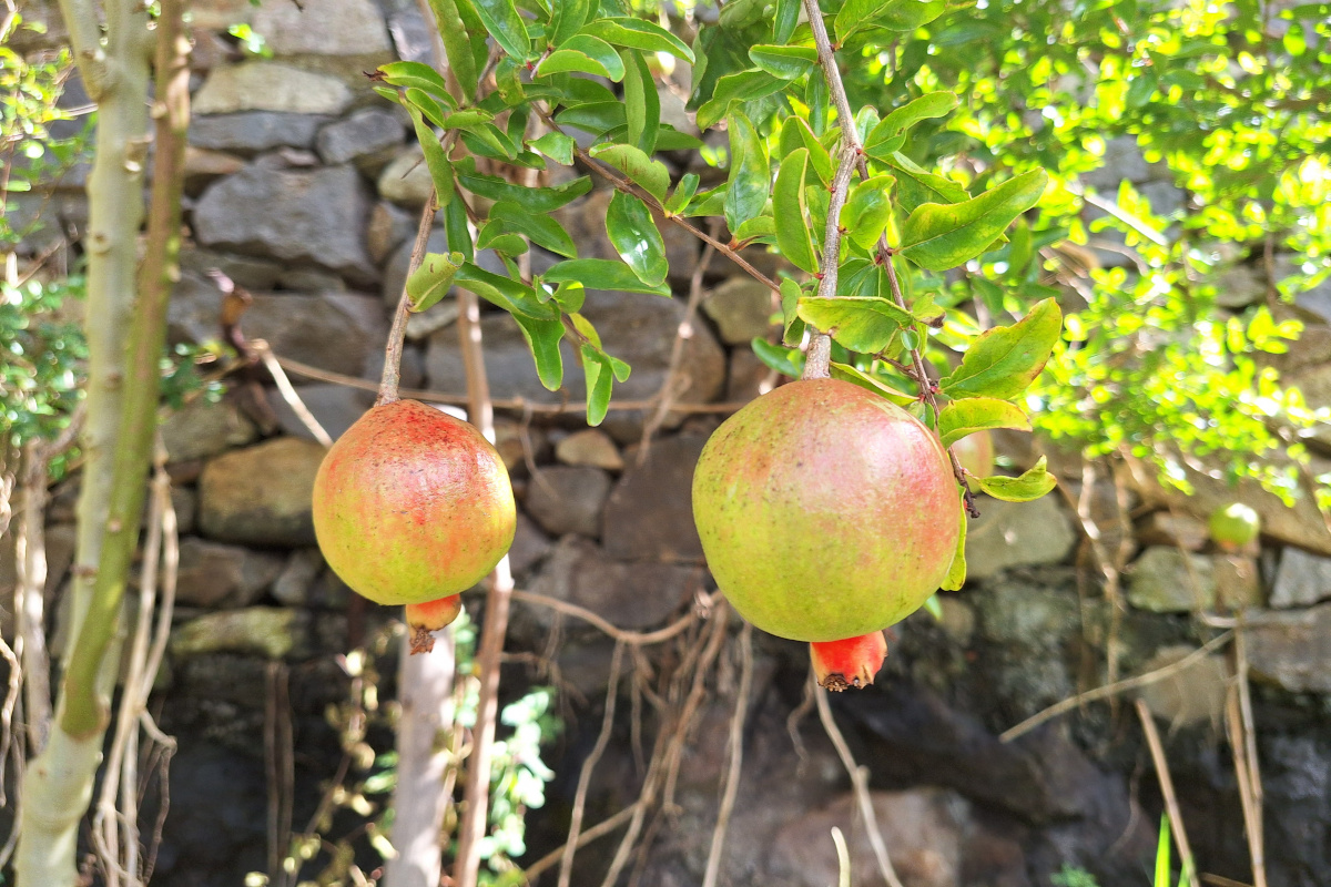
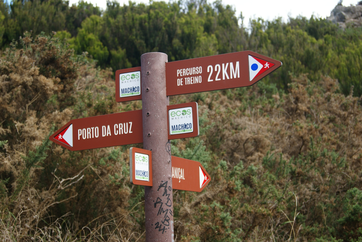
After a short car ride and passing Caniçal, we parked on the ER109 road near the old tunnel, where we started with Levada do Caniçal. We were following Organic Maps because we hadn’t seen any trail signs next to the road. First, the path passed many houses, and we admired pomegranate trees and hydrangeas that still had nice colors if growing in the shade. From the very beginning, we followed a small levada. Once we reached the local road, we had to look for a sharp turn to the left, which was luckily marked on a stone pointing to Vereda da Boca do Risco. The first few kilometers led close to fields where local people grow their crops and vegetables. Next, the path entered the forest, where we saw goats running around.
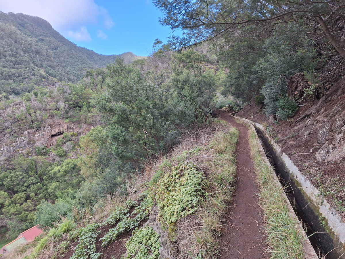
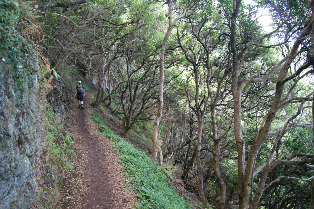
The forest became denser, the path steeper and rockier. We passed only a few people and a trail runner before reaching the top. When the ocean view opened, and we reached Vereda do Larano, the landscape changed dramatically. We were now walking along a steep slope, but luckily, small trees growing there created a feeling of protection. This part of the hike was definitely more crowded but not to the point that it would negatively affect our experience.
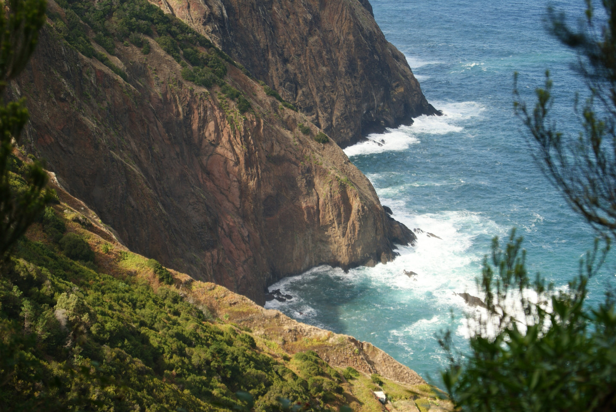
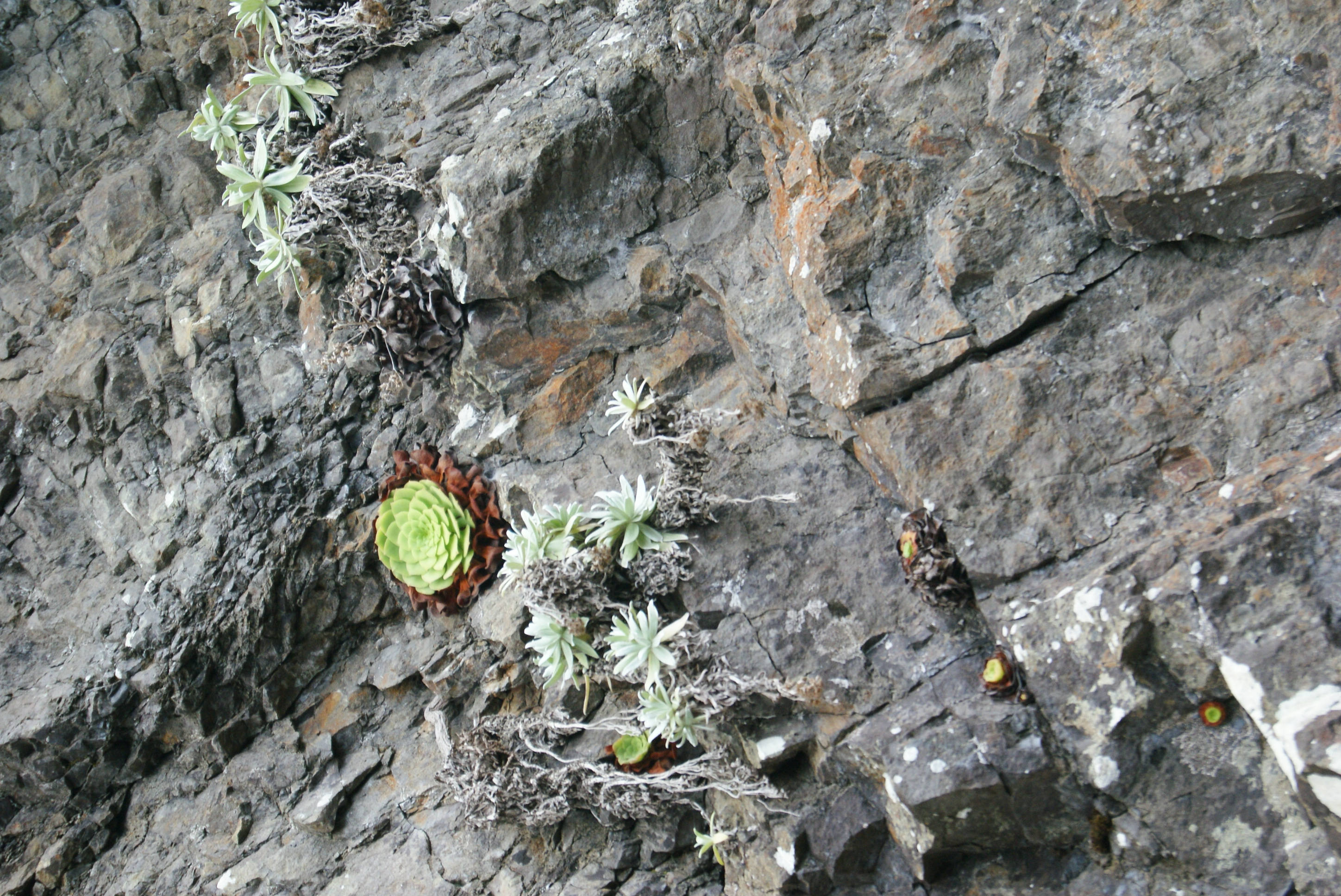
In the most exposed parts, there was a wire fence. It got quite windy, but we could admire stunning cliffs for most of the hike, so it was definitely worth exploring this area. Also, the rocks next to the trail were covered with numerous succulents. We mostly know these from garden centers, so seeing them thrive on the rugged, nearly vertical rocks beside us was unexpected—a beautiful reminder of nature’s resilience. At one point, we even noticed majestic Ponta de São Lourenço peninsula far in a distance.
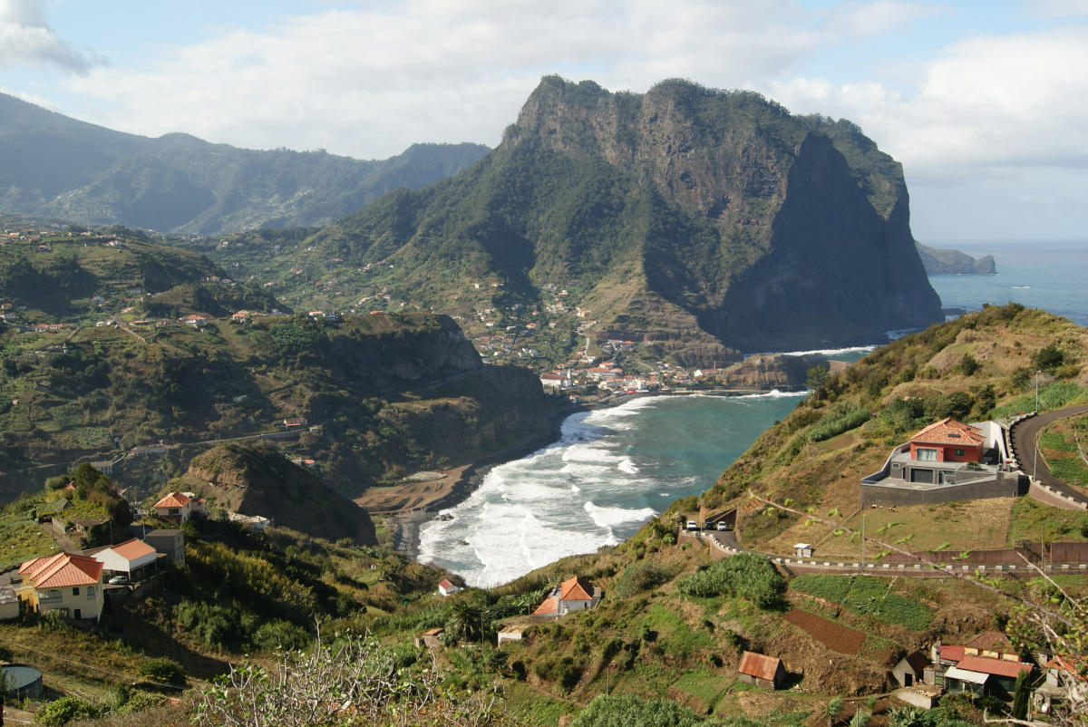
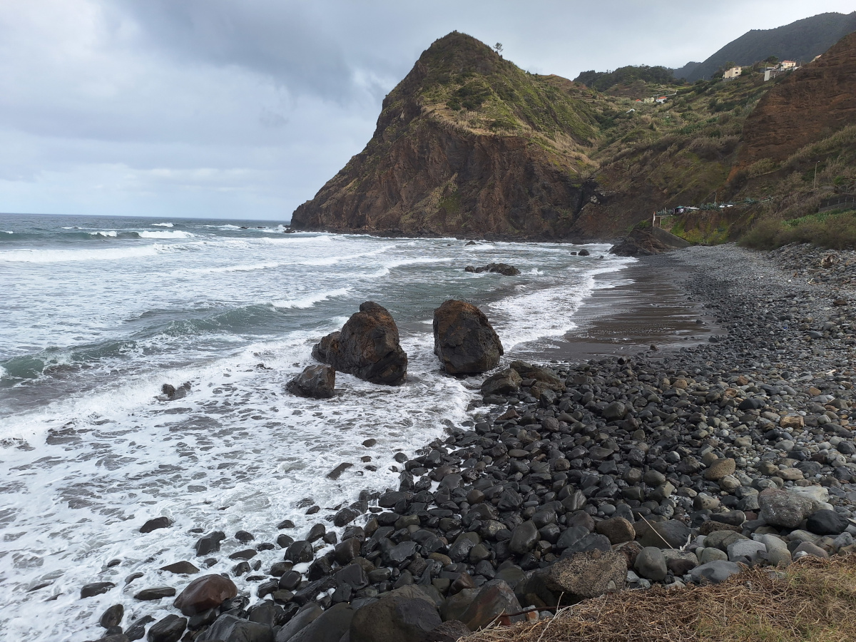
After passing the rusty-looking cable car near Porto da Cruz, we followed the road for a moment where many cars were parked as most people start their hike here and return to the same place (out and back variant of the hike). Next, we turned onto a path leading through fields and a nearby hill to admire the view of the city (marked as the only dashed line near the coast in Organic maps app). It’s also possible to just walk along the road, but it is longer and less safe. Finally, we reached the black sand and pebble beach and followed the coastline until the city center. Below, you can see in the photo Penha de Águia towering over the city. This volcanic rock formation clearly dominates the landscape, standing at almost 600m in height! It was a very diverse hike, starting with dirt paths, forested sections, and finally reaching a dramatic cliffside walk. It was relatively easy but had some narrow and exposed areas—not for those really afraid of heights!
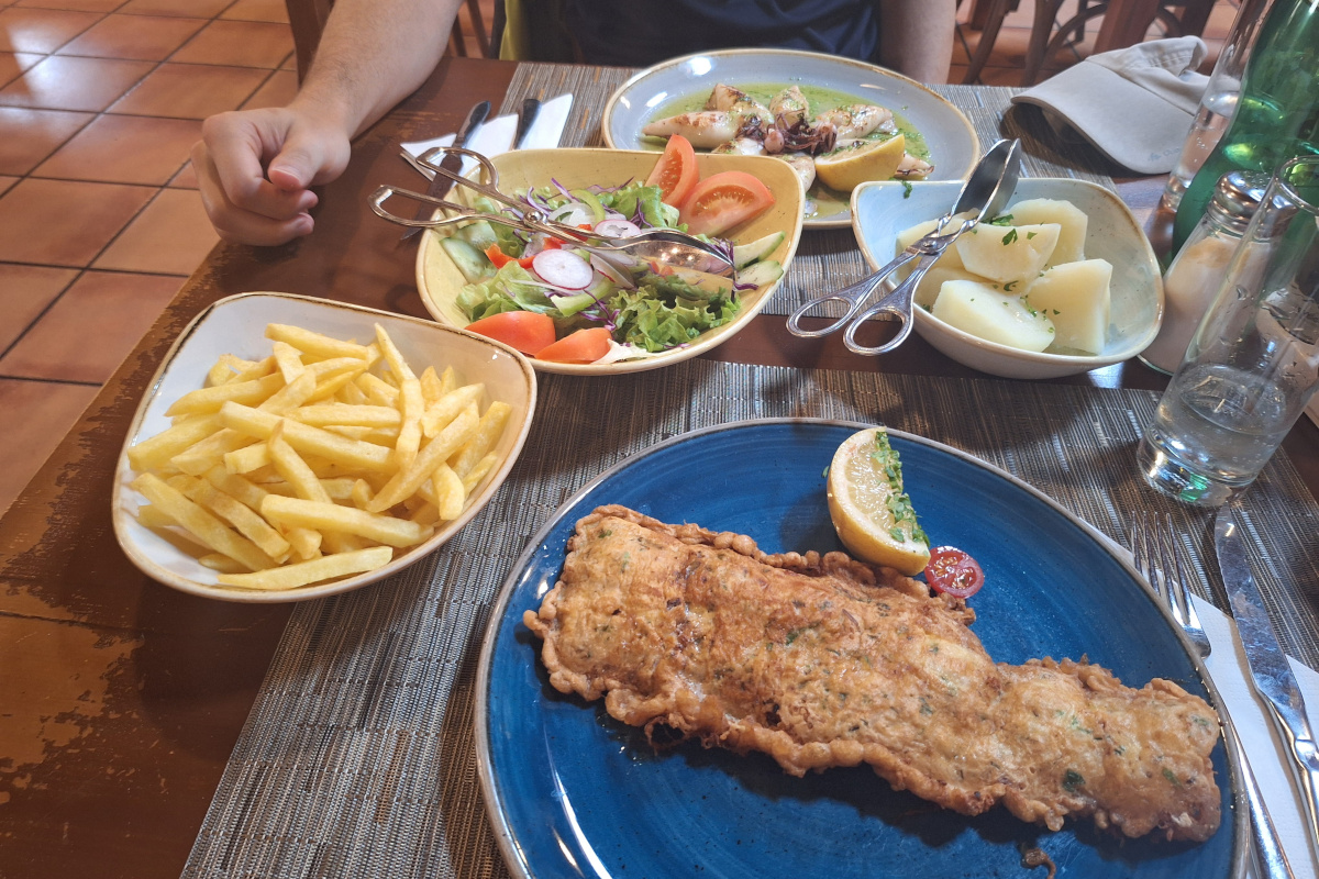
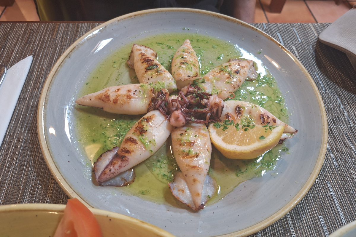
Now it was time for a proper meal after this exhausting day. Since there was only one available Bolt driver, taking a normal taxi back to our car was now the cheaper option. We were happy with this decision despite the extra cost because it allowed us to complete a longer hike without repeating any part of it.
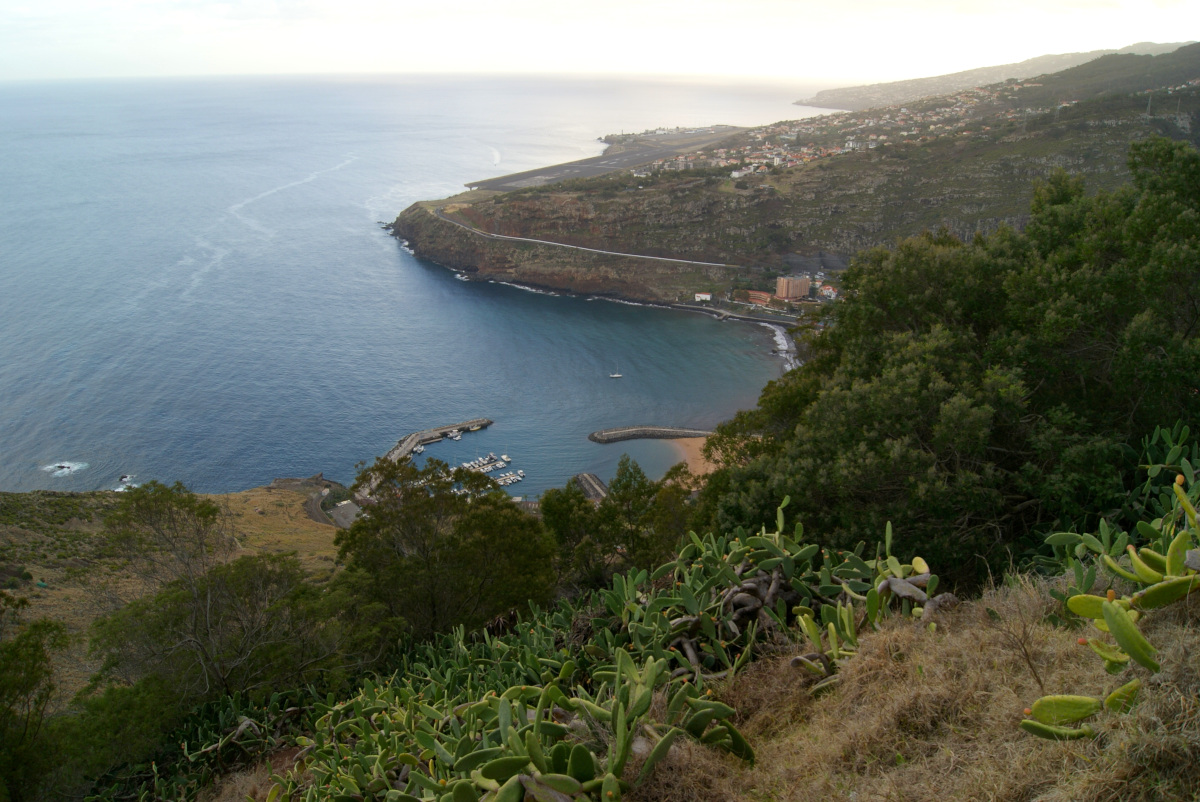
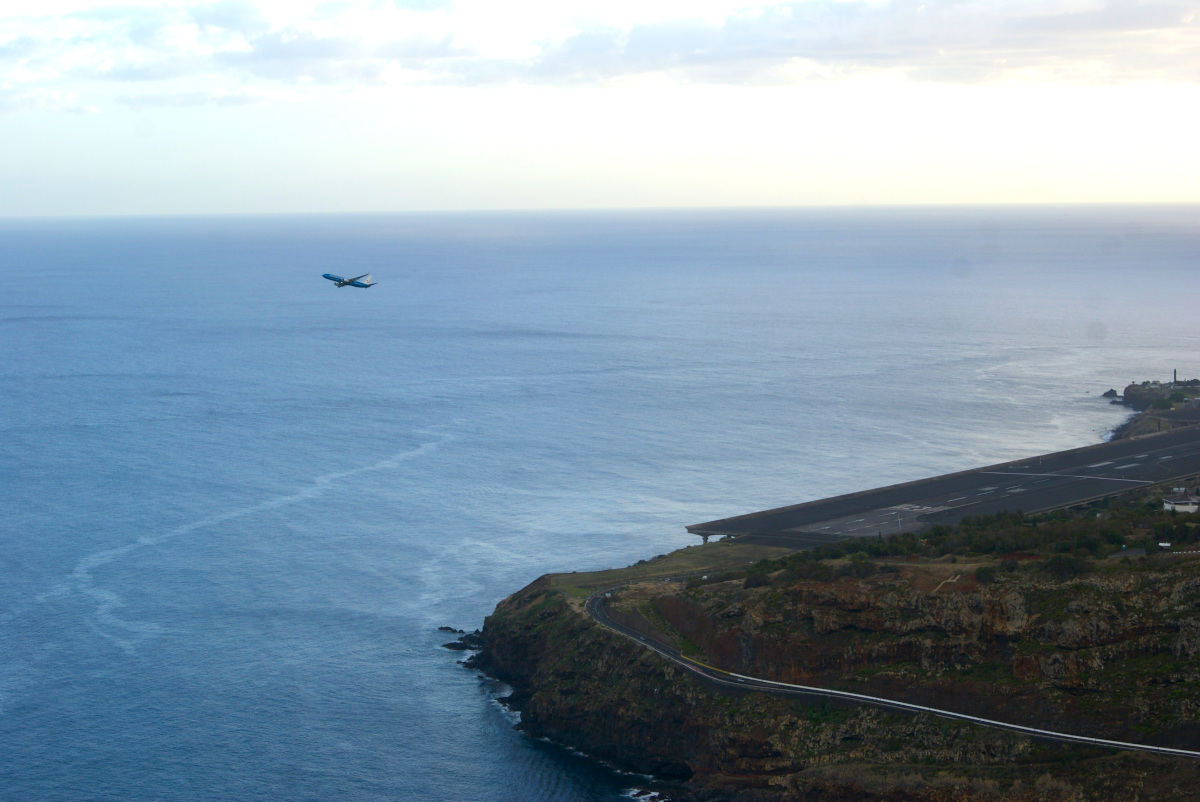
Since we still had some time, we decided to finish the day at Miradouro do Pico do Facho, just a little over 1 km from our car, where we could admire the view of Cristiano Ronaldo International Airport. I was shocked in the morning when I realized that, at one point, we were driving underneath the airport runway! Madeira Airport has a unique elevated runway extension, supported by large concrete pillars, allowing vehicles to pass underneath. This extension was built to accommodate larger planes and improve safety, as the original runway was quite short and challenging for landings. The road that passes beneath is part of the VR1 highway, making it a really cool experience for drivers. Miradouro do Pico do Facho was a peaceful spot to sit and relax, surrounded by large cactuses. There were also restrooms and a small snack bar, though it was closing when we arrived after 5 PM.
Next, we’ll explore Madeira’s West Coast and natural pools in Porto Moniz so stayed tuned!
Practical info:
-
Official website to check if hiking trails are open after the wildfires that occurred during the summer.
- Tickets for paid hiking trails can be bought online on this website. From January 1, 2025, non-residents will need to pay to hike on over 30 routes managed by the Institute of Forests and Nature Conservation (ICNF) in Madeira. These are basically all hikes marked as PR.
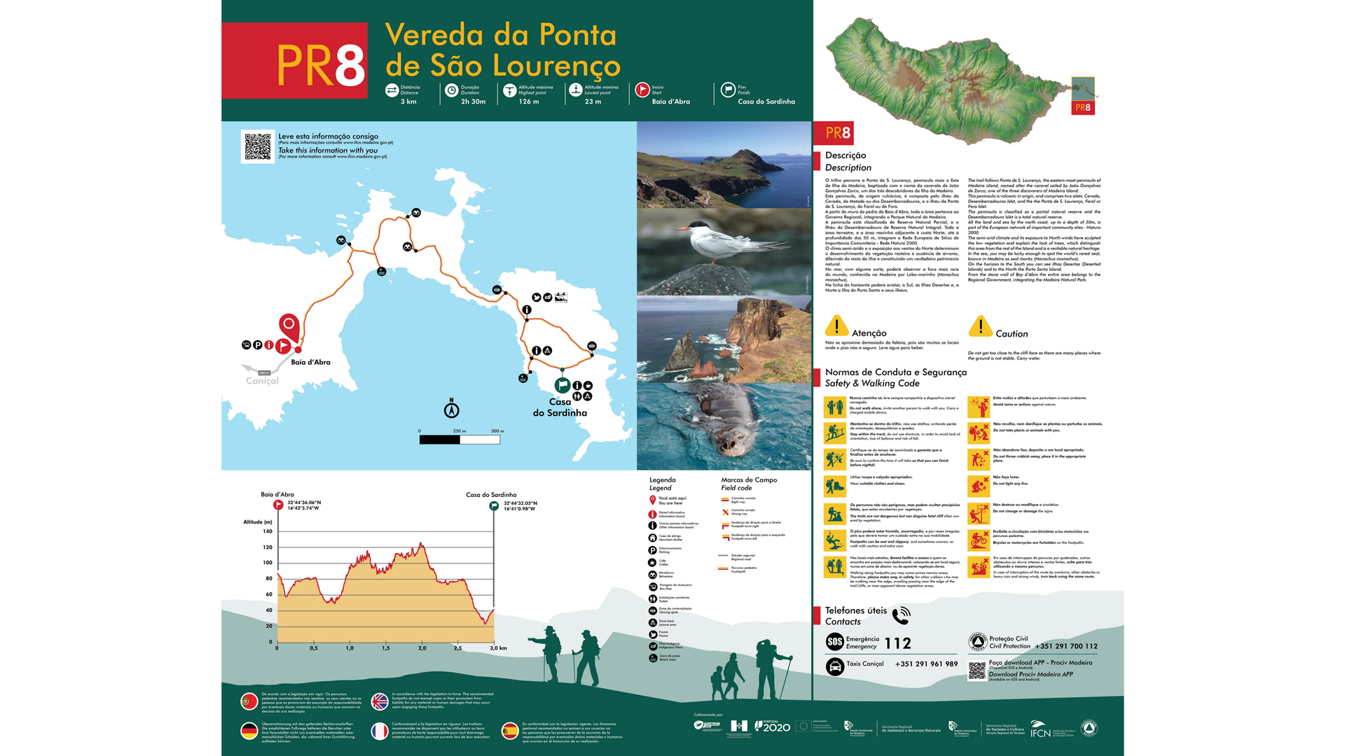
- Ponta de São Lourenço ‘The Dragon’s Tail’ – 7.5 km, 2h30min. This hike already had an entrance fee of 1 euro before the most recent changes. Looking at our hike and the official map now, I wonder if the last part after the bar is even an official trail—maybe that’s why it was not properly maintained. However, there was no sign or information indicating that we shouldn’t continue, at least none that we noticed. We just followed a well-visible path to the end, deliberately skipping the restaurant since we didn’t have time for an extra break. PR8 and a detailed summary of the hike can be found on official websites.
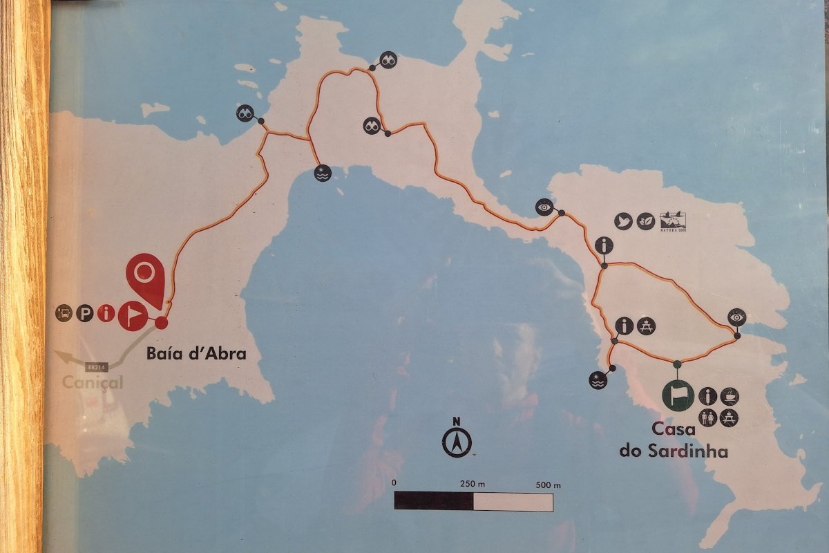
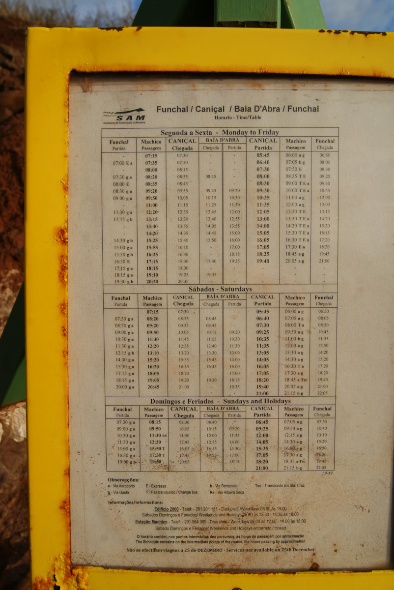
It is also possible to get here by 113 bus from Funchal, see schedule below (photo from the bus stop at São Lourenço parking). Overall, the path is well maintained in the main section but not at the beginning, where many wooden boards are missing or broken, and not after passing the café (still questionable whether this is part of the official hike).
-
Miradouro da Ponta do Rosto - small parking area, but people come and go quickly, so finding a spot for a short 10-minute stop is usually not a problem.
-
Levada do Caniçal - Vereda da Boca do Risco - Vereda do Larano - Porto da Cruz – 13.44km, 3h30min Taxi back to the car 18euro, 11km ride (only one available car on Bolt app but more expensive, 24euro). We left the car at: P6MP+44 Machico, Portugal

-
During our travels, we always use Organic Maps: Offline Hike, Bike, Trails, and Navigation app, which was very accurate on Madeira—we didn’t get lost even once. We didn’t even need to use the app during the first hike of the day, but the coastal hike was more complicated since we were hiking on parts of different trails. We noticed only one proper wooden post when we reached the crossing between Vereda da Boca do Risco and Vereda do Larano (the first viewpoint with an ocean view).
-
Restaurant A Pipa - restaurant & bar with big portions, clean, and tasty food. About 20 euro per person including drinks. Address: Casas proximas, 9225-050 Porto da Cruz, Portugal
Subscribe via RSS